Many of us use Google Maps. If you don’t have a GPS, it is usually the #1 site you will go to to get directions. It is mostly accurate, clean free, and of course, by Google.
But one thing that many people find useful is Street view. Before they go, they can see whta their destination should look like so you arent frantically searching for house numbers when you supposedly arrived.
If you have played with Street View before, you may have found that you can drag 360º PLUS go up and down. How were these images captured?
And just in case you havent played with Street View before, click here to go to google maps and click the little golden dude over the vertical zoom bar on the left of the map to get a street view of times square, NY. Click and drag the image to pan this 360º panoramic snapshot. The truth will be revealed now…
It’s a normal monday. La la, coming home from school, lots of traffic WHOW WHAT IS THAT!!
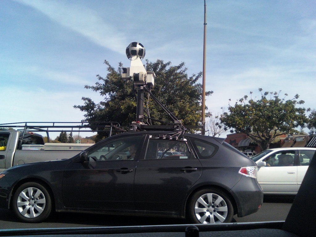
It took me a few seconds to realize t but it was the same kind of rig that google used to get their Street View shots. Here’s the pic I took with my phone:
As you can tell, it is this sphere mounted on top of a car. the sphere has numerous cameras in little holes that all take pictures at once. Then, someone puts them all together. So if you see this UMO (Unidentified Mobile Object) around your town, start jumping around in hope that your streets may soon have street view in Google Maps.
Have you found something cool just like this, but have nowhere to post it? Don’t want to start your own blog because you might not actually have THAT MANY thoughts to post? Post it to the community for free at http://community.goodmorninggeek.com!


Nice Pic